In Hobart, many proposed landfill sites occupy former alluvial flats or weathered dolerite slopes west of the Derwent estuary. The team routinely finds variable fill sequences overlying silty clay layers that were once river terraces. A proper geotechnical investigation here must define the hydraulic conductivity of the foundation soil and the integrity of the natural barrier. Before designing the liner system, we recommend a permeability field test to measure in-situ flow rates across the proposed cell footprint. That data directly informs whether a compacted clay liner alone will meet the required 1×10⁻⁹ m/s target, or if a geomembrane must be specified from the start.
A compacted clay liner in Hobart’s wet climate must achieve a hydraulic conductivity of 1×10⁻⁹ m/s — a standard that demands rigorous QC testing every 250 m³.
Methodology and scope
- Borehole drilling to 15–25 m depth with SPT at 1.5 m intervals (AS 1289.6.3.2)
- Piezometer installation for groundwater monitoring across at least two wet seasons
- Laboratory triaxial and consolidation tests on undisturbed samples
- Chemical compatibility testing of site soils with potential leachate
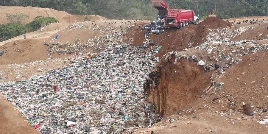
Local considerations
A frequent mistake on Hobart landfill projects is assuming the natural dolerite or siltstone provides an adequate low-permeability barrier without verification. Fractured dolerite can transmit water orders of magnitude faster than intact rock, and a single unfilled joint can bypass the entire containment system. Without a comprehensive hydrogeological assessment that includes packer testing in bedrock and long-term monitoring of perched water tables, the risk of undetected leakage remains unacceptably high. Regulators under the Tasmanian Environment Protection Authority now require a detailed water balance and a verified liner equivalence before issuing a permit. Skipping these steps leads to costly remediation orders.
Applicable standards
AS 1726:2017 — Geotechnical site investigations, AS 4678:2002 — Earth-retaining structures, AS/NZS 1170.0:2002 — Structural design actions (general principles), EPA Tasmania — Landfill Waste Classification and Waste Disposal (2020)
Associated technical services
Liner System Design and Permeability Testing
We engineer compacted clay liners, geosynthetic clay liners, and composite geomembrane systems in accordance with AS 1726. Field permeability tests using sealed double-ring infiltrometers and laboratory triaxial permeability tests confirm that every lift meets the specified hydraulic conductivity before the next lift is placed.
Slope Stability and Leachate Management
Using limit-equilibrium software (Slide, Slope/W), we evaluate internal and external stability of the waste mass and the containment berms. The analysis incorporates leachate mounding scenarios, rapid drawdown after extreme rainfall, and seismic loading per AS/NZS 1170.4. We also design the leachate collection and removal system to maintain the maximum head on the liner below 300 mm.
Typical parameters
Frequently asked questions
How deep do boreholes need to go for a landfill geotechnical investigation in Hobart?
Boreholes typically extend 5 to 10 m below the proposed liner base, or until a low-permeability stratum of at least 3 m thickness is confirmed. In dolerite terrain, the depth may increase to 15 m to penetrate weathered rock and reach competent material. The investigation must also define the seasonal high groundwater level, so standpipes are installed and monitored for a minimum of three months.
What tests are required to verify a clay liner meets the hydraulic conductivity standard?
The primary test is the flexible-wall triaxial permeability test (AS 1289.6.7.2) performed on undisturbed tube samples from each compacted lift. Alternatively, sealed double-ring infiltrometer tests (AS 1289) can be run in situ. The acceptance criterion is a hydraulic conductivity ≤ 1×10⁻⁹ m/s. A minimum of one test per 250 m³ of placed clay is the recommended frequency, increasing to one per 100 m³ near the liner edges.
What is the typical cost range for a landfill geotechnical investigation in Hobart?
The cost depends on the site area, depth of investigation, and number of boreholes. For a medium-sized cell (2–4 hectares), the geotechnical investigation including drilling, laboratory testing, and reporting typically ranges between AU$3.470 and AU$14.380. Complex sites with deep dolerite or perched groundwater may exceed that range. Obtaining multiple quotes from NATA-accredited laboratories is advisable.